Discover Pandipedia
Pandipedia is the world's first encyclopaedia of machine generated content approved by humans. You can contribute by simply searching and clicking/tapping on "Add To Pandipedia" in the answer you like. Learn More
Expand the world's knowledge as you search and help others. Go you!
Let's look at alternatives:
- Modify the query.
- Start a new thread.
- Remove sources (if manually added).
- Request a manual search from our human research team.
Let's look at alternatives:
- Modify the query.
- Start a new thread.
- Remove sources (if manually added).
- Request a manual search from our human research team.
Get more accurate answers with Super Search, upload files, personalised discovery feed, save searches and contribute to the PandiPedia.
Engagement farming is a strategy aimed at maximizing interactions on social media content through various manipulative tactics. This includes provoking responses with controversial posts, asking leading questions, and using clickbait headlines to create artificial engagement[1][3][4]. It operates on the principle that higher engagement boosts visibility on platforms like Twitter, Instagram, and Facebook, as algorithms prioritize such content[3][5]. Users often adopt inauthentic methods like follow-for-follow schemes and comment pods to inflate their metrics, while the true content remains lacking in genuine interest or connection[2][5]. As a result, while engagement farming can temporarily increase numbers like likes and shares, it may ultimately harm credibility and not yield a loyal following[2][3].
Let's look at alternatives:
- Modify the query.
- Start a new thread.
- Remove sources (if manually added).
- Request a manual search from our human research team.
Let's look at alternatives:
- Modify the query.
- Start a new thread.
- Remove sources (if manually added).
- Request a manual search from our human research team.
Let's look at alternatives:
- Modify the query.
- Start a new thread.
- Remove sources (if manually added).
- Request a manual search from our human research team.

Search ads help to satisfy demand, while brand advertising, display advertising, helps to create demand.
Dr. Hal Varian[1]
Search advertising is one of the world's greatest business models ever created
Mike Roszak[2]

Advertisers are losing control because of the multiple different reasons, again, they're losing control.
Professor Jerath[1]
Search ads and display ads are not seen as substitutable by booking.com.
Professor Jerath[1]
Google's financial incentive to break that promise is pretty evident.
Dr. Baker[4]
Let's look at alternatives:
- Modify the query.
- Start a new thread.
- Remove sources (if manually added).
- Request a manual search from our human research team.
Get more accurate answers with Super Search, upload files, personalised discovery feed, save searches and contribute to the PandiPedia.

Yung Filly's comedy is characterized by his infectious energy and relatability, traits that stem from his loud upbringing in a family that encouraged confidence through humor. He expresses that what audiences see on screen reflects his genuine personality, stating, “what you see on the screen is actually me”[2]. His comedic style combines fun skits and engaging content that resonates with viewers, especially in his 'Asking Awkward Questions' series, which showcases his relatability and ability to connect with the audience[3][5].
In contrast to more scripted content, Yung Filly's approach often emphasizes spontaneity and authenticity, as illustrated by his preference for creating raw, unscripted videos with friends like Chunkz, which he finds effective in engaging viewers[5].
Let's look at alternatives:
- Modify the query.
- Start a new thread.
- Remove sources (if manually added).
- Request a manual search from our human research team.
Let's look at alternatives:
- Modify the query.
- Start a new thread.
- Remove sources (if manually added).
- Request a manual search from our human research team.
Overview and Geological Context

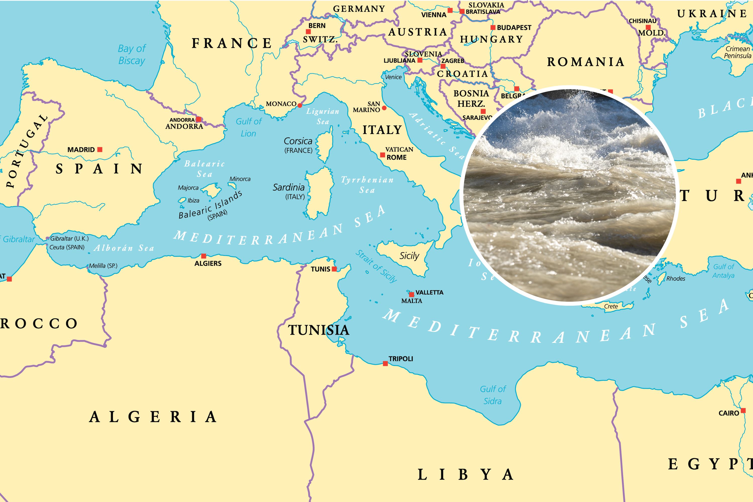
The Zanclean Megaflood refers to a proposed catastrophic flooding event that refilled the Mediterranean Sea at the end of the Messinian Salinity Crisis (MSC), which occurred between approximately 5.97 and 5.33 million years ago. During the MSC, the Mediterranean was largely isolated from the Atlantic Ocean, causing evaporation that transformed the sea into extensive salt flats. A number of studies now suggest that rather than a gradual reentry of water over thousands of years, there was an abrupt, high‐discharge flood that restored marine conditions rapidly. As stated in one source, “The Zanclean megaflood was an awe-inspiring natural phenomenon, with discharge rates and flow velocities dwarfing any other known floods in Earth’s history”[1][4][9]. This event is believed to have reconnected the Mediterranean with the Atlantic through a breach at the Strait of Gibraltar before spilling over into the eastern basin via a submerged land bridge called the Sicily Sill.
Evidence from Geological and Geophysical Observations
Multiple research teams have compiled extensive evidence for the highly catastrophic nature of the Zanclean Megaflood. Observations of more than 300 asymmetric, streamlined erosional ridges on and around the Sicily Sill indicate that powerful flows of turbulent water sculpted the landscape. As one study notes, the morphology of these ridges is “compatible with erosion by large-scale, turbulent water flow with a predominantly north-easterly direction”[6][14]. Geological sampling of these ridges revealed a layer of rocky debris on top that is interpreted as rapidly deposited material eroded from the ridge flanks and adjacent areas. This debris layer, which marks the boundary between the Messinian and Zanclean periods, is a key piece of evidence supporting the sudden onset of the megaflood[1][5][14].
Furthermore, seismic reflection data have uncovered a distinctive “W-shaped channel” on the continental shelf east of the Sicily Sill. This channel appears to connect the erosional features onshore to deep submarine canyons, particularly the Noto Canyon, thereby acting as a funnel for the massive floodwaters[6][11][27]. Such geophysical imaging has been crucial in confirming that these features are not the result of gradual processes but instead reflect the high-energy dynamics of a catastrophic flood event.
Flow Dynamics and Modeling Results
Hydrodynamic models have been used to simulate the behavior of the megaflood. These computer simulations helped estimate peak flow velocities, discharge rates, and the evolution of the flood as it transitioned from the western to the eastern Mediterranean basin. Model predictions suggest that discharge rates during the event ranged between 68 and 100 Sverdrups (with one Sverdrup equaling one million cubic meters per second)[2][8][14][27]. The floodwater is estimated to have reached speeds of up to 32 meters per second (72 miles per hour), and computer models indicate that as the water spilled over the Sicily Sill, its flow direction altered gradually in a clockwise manner, deepening channels further downstream[5][6][13].
These dynamic simulations are supported by geological evidence; for instance, the deposition of bedload debris and the formation of streamlined ridges are consistent with rapid, high-energy water flows that can modify both subaerial and submarine landscapes almost instantaneously on a geological timescale[1][13][19].
Implications for Mediterranean Evolution and Global Significance
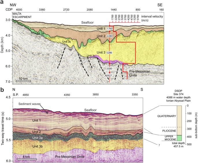
The reintroduction of water during the Zanclean Megaflood not only refilled the Mediterranean basin dramatically but also had long-lasting effects on regional topography and sediment deposition. The flood is implicated in the formation of vast sedimentary deposits in the western Ionian Basin, with estimates suggesting that volumes up to 1,600 cubic kilometers of chaotic megaflood sediment were transported and deposited over a short time span[8][16][25].
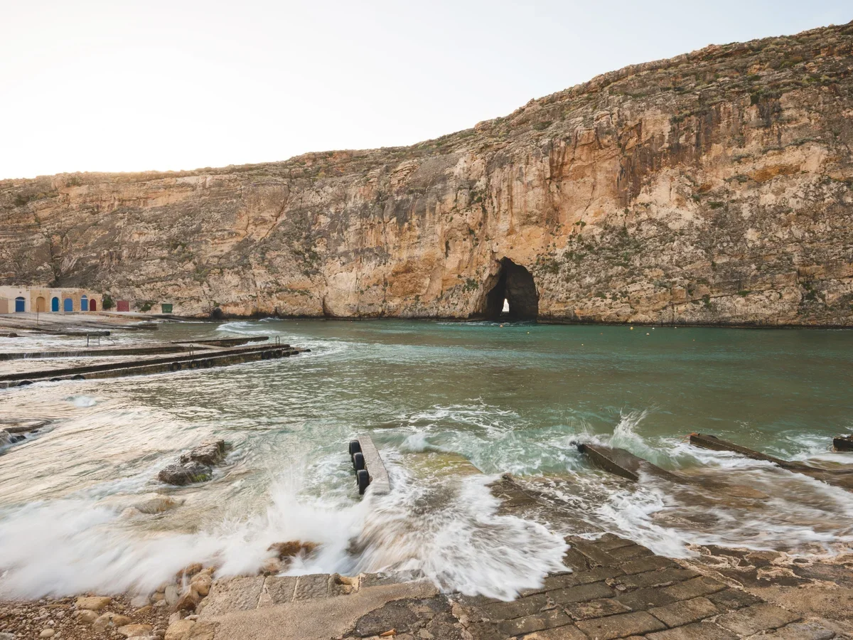
Beyond reshaping the local landscape, the event had broader implications. Various studies have noted that such a massive and rapid influx of water would have induced seismicity, contributed to the erosion of canyons along the Malta Escarpment, and influenced the later development of Mediterranean ecosystems and human settlement patterns. As research has shown, “These findings not only shed light on a critical moment in Earth’s geological history but also demonstrate the persistence of landforms over five million years”[9][16][18].
Importantly, the evidence for this event challenges previous models that favored a slow, gradual reconnection of the Mediterranean with the Atlantic. New data suggest that the basin underwent a dramatic environmental transformation over a timescale of only a few years, rather than the previously assumed 10,000 years[4][20][24]. This recognition alters long-standing perspectives on the interplay between tectonics, climate, and oceanography in the Mediterranean region, and it provides a compelling example of how catastrophic events can dominate Earth's geological record.
Concluding Remarks
A synthesis of evidence from diverse sources, including geological field observations, seismic imagery, and numerical modeling, strongly supports the hypothesis of the Zanclean Megaflood as a rapid and massive event that refilled the Mediterranean Sea at the end of the Messinian Salinity Crisis. Multiple independent studies converge on key points: the identification of over 300 streamlined erosional ridges, the rapid deposition of debris marking the critical boundary between geological periods, the discovery of a W-shaped subaqueous channel acting as a funnel for catastrophic flows, and model estimates indicating unprecedented water discharge rates and velocities[1][2][3][4][6][8][11][14][16][19][24][27][29].
This comprehensive picture reinforces the idea that Earth’s history is punctuated by sudden, extreme events capable of reshaping entire regions. The Zanclean Megaflood serves as a dramatic example of such processes, reminding us that even vast ocean basins can be transformed in a matter of years due to the dynamic forces of water and tectonics. Continued research and exploration along the Mediterranean margins promise to further illuminate the details of this extraordinary event and its lasting legacy on our planet[7][10][12][15][17][20][21][22][23][25][26][28][30].
Let's look at alternatives:
- Modify the query.
- Start a new thread.
- Remove sources (if manually added).
- Request a manual search from our human research team.

The equator is significant for several reasons. It is an imaginary line at 0 degrees latitude that divides Earth into the Northern and Southern Hemispheres, serving as a reference point for the latitude system used in mapping (which includes imaginary east-west lines called parallels)[2][4].
Geographically, the equator is where Earth's circumference is greatest, measuring about 40,075 kilometers (24,901 miles)[3][5]. This unique position also results in an equatorial bulge, meaning that Earth's diameter at the equator is approximately 12,756 kilometers (7,926 miles), compared to about 12,714 kilometers (7,900 miles) at the poles[3].
Climatically, the equator experiences a stable warm climate year-round, with very little seasonal variation. Instead of traditional seasons, regions around the equator generally recognize wet and dry seasons due to their proximity to the Sun, which is almost directly overhead at noon throughout the year[3][5]. Furthermore, during equinoxes, the sun passes directly over the equator, leading to nearly equal lengths of day and night[2][5].
Additionally, the equator is crucial for understanding Earth's climatic zones and ecosystems, particularly the lush tropical rainforests found in equatorial regions, which boast high biodiversity[1][3]. Overall, the equator is a key reference in geography, climate science, and environmental studies.
Let's look at alternatives:
- Modify the query.
- Start a new thread.
- Remove sources (if manually added).
- Request a manual search from our human research team.


